If you ever wondered where the streets in and around Molalla got their names, look no further! This is a living document, so if you see a missing street and you’d like to add it, drop us a note. If you think an entry has incorrect information, please let us know of that as well. Enjoy!
| Street_Name | Name_Origin |
|---|---|
| 2ND_ST_(97038) | Common_numerical_sequence |
| 3RD_ST_(97038) | Common_numerical_sequence |
| 3RD_ST_(97038) | Common_numerical_sequence |
| 4TH_ST_(97038) | Common_numerical_sequence |
| 5TH_ST_(97038) | Common_numerical_sequence |
| 6TH_ST_(97038) | Common_numerical_sequence |
| 7TH_ST_(97038) | Common_numerical_sequence |
| 8TH_ST_(97038) | Common_numerical_sequence |
| ACER_LN_(97038) | |
| ADAMS_CEMETERY_RD_(97038) | Named_after_WD_Adams_and_early_settler_of_1850;_furniture_and_coffin_builder;_DLC_east_of_town |
| ADAMS_RD_(97038) | Named_after_WD_Adams_and_early_settler_of_1850;_furniture_and_coffin_builder;_DLC_east_of_town |
| AFFOLTER_AVE_(97038) | |
| ALEX_AVE_(97038) | |
| ALYSSA_CT_(97038) | Nammed_after_Alyssa_Post,_daughter_of_Eric_Post,_owner/broker_of_Better_Homes_and_Garden’s_Real_Estate_that_use_to_be_in_town |
| ANNE_LN_(97038) | |
| APPALOOSA_DR_(97038) | This_road,_along_with_Cayuse,_named_with_a_native_american_theme._ Off_of_Vick_road. |
| APPLEMAN_RD_(97038) | Named_after_the_Appleman_Family_-_ask_Ed_Appleman,_MAHS_member_abt_his_family |
| AQUA_SPRINGS_RD_(97038) | |
| AUTUMN_WAY_(97038) | |
| BABCOCK_LN_(97038) | Named_after_Ken_and_Judy_Babcock. |
| BAGBY_RD_(97038) | Named_after_Wm_and_Harriet_Bagby,_founder_of_Bagby_Hot_Springs,_early_settler,_property_was_at_Dickey_Prairie,_1853 |
| BALL_RD_(97038) | |
| BARBARA_WAY_(97038) | |
| BARNARDS_RD_(97038) | |
| BEAR_MEADOW_CT_(97038) | |
| BERKELEY_AVE_(97038) | |
| BERWICK_CT_(97038) | |
| BIG_LEAF_RD_(97038) | |
| BIRD_RD_(97038) | |
| BLAIR_RD_(97038) | |
| BLUE_RD_(97038) | |
| BOARDWALK_AVE_(97038) | In_Toliver_Estates,_owned_by_Loren_McLeod,_all_streets_are_Monopoly_properties |
| BOSTON_CT_(97038) | |
| BOYLERD_(97038) | |
| BRONCO_AVE_(97038) | Shelmar_subdivision,_developed_by_Wayne_Scott,_named_streets_for_Ford_vehicles. |
| BRUCE_TOMLIN_ST_(97038) | |
| BUD_SMITH_RD_(97038) | Part_of_the_Andrew_Johnson_land_donation_claim.__Fernwood_area__ |
| BURGHARDT_DR_(97038) | For_the_Burghardt_family_who_owned_the_property_where_Big_Meadow_now_is_(Dale_Burghardt_developer) |
| BUTTE_CREEK_RD_(97038) | Named_after_Butte_Creek_that_runs_along_the_road.__Guessing_that_the_creek_comes_from_a_nearby_Butte. |
| CALLAHAN_RD_(97038) | Dickey_Prairie,_one_of_the_3_early_DLC_holders_Clifton_Callahan_-_had_13_children |
| CAROL_CT_(97038) | For_Carol_Wrolstad_(?) |
| CARTER_LN_(97038) | |
| CASCADE_LN_(97038) | |
| CASCADIA_CT_(97038) | |
| CAYUSE_CT_(97038) | This_road,_along_with_Appaloosa,_named_with_a_native_american_theme.__Off_of_Vick_road. |
| CEMETERY_RD_(97038) | The_road_that_leads_out_to_the_cemetery_in_Scotts_Mills. |
| CENTER_ST_(97038) | |
| CHINOOK_ST_(97038) | Part_of_Molalla_River_Estates_modern_subdivision_NE_of_town_-_they_all_have_fish_names |
| CHRISTOPHER_CT_(97038) | |
| CLAIM_RD_(97038) | |
| COHO_ST_(97038) | Part_of_Molalla_River_Estates_modern_subdivision_NE_of_town_-_they_all_have_fish_names |
| COLE_AVE_(97038) | Named_after_the_Cole_family,_early_settlers_of_Molalla. |
| COLE_CT_(97038) | Named_after_the_Cole_family,_early_settlers_of_Molalla. |
| COLUMBIA_DR_(97038) | |
| COMER_CREEK_DR_(97038) | |
| COMMERCIAL_PKWY_(97038) | Relatively_new_road_in_west_Molalla_whee_commercial_light_industry_is_located. |
| COOPER_RD_(97038) | Named_after_the_Cooper_family |
| CORRAL_CT_(97038) | |
| CRAMER_RD_(97038) | |
| CREAMERY_CREEK_DR_(97038) | This_is_the_road_the_creamery_(butter_churning)_was_located. |
| CROMPTON_LN_(97038) | |
| CROSSOVER_RD_(97038) | |
| CRUSHER_RD_(97038) | |
| DART_RD_(97038) | C.B._and_Isabella_Dart_from_Illinois_and_Virginia,_DLC_early_1850s |
| DEARDORFF_RD_(97038) | Named_after_the_Deardorff_family.__Logging,_trucking,_real_estate…_still_big_in_Molalla. |
| DHOOGHE_RD_(97038) | Dhooge_family_early_Meadowbrook/Milk_Creek_family_-_off_of_Hwy_211_as_it_heads_east_into_Colton |
| DICKEY_PRAIRIE_RD_(97038) | Named_after_John_Dickey,_settler_in_the_area_1847;_Is_also_called_Seth_Austin_Hwy_on_the_old_plates. |
| DIXON_AVE_(97038) | |
| DRESSLER_LN_(97038) | The_Dressler_family_owned_the_meat_company_at_the_end_of_the_lane_(slaughter_house/butcher) |
| DRYLAND_RD_(97038) | |
| DUNRUD_LN_(97038) | Art_Dunrud,_father_of_Dennis_Dunrud.__It_may_have_gone_back_a_generation_from_Art,_however. |
| EBY_RD_(97038) | Named_after_John_Wesley_Eby_and_Almira_Eby,_settlers_in_the_area_around_1909. |
| ECKARD_ST_(97038) | |
| EL_RANCHO_RD_(97038) | |
| ELISHA_RD_(97038) | |
| ELK_HAVEN_RD_(97038) | |
| ELK_PRAIRIE_RD_(97038) | Named_for_the_area_called_Elk_Prairie,_way_down_south_of_Sawtell. |
| ELLIS_RD_(97038) | |
| ENGLE_AVE_(97038) | Named_for_William_Engle,_one_of_the_early_settlers_of_Molalla_in_1845._ He_had_one_of_the_four_corners_in_the_center_of_town_(DLC)._ Great-great_grandfather_of_Lois_Ray,_MAHS_member!_William_was_from_Harper’s_Ferry,_West_Virginia._William_went_to_Missouri_after_his_3rd_wife_died_and_married_Susan,_whom_he_brought_back_to_live_with_him_in_Molalla._ |
| ERIC_DR_(97038) | |
| ESCORT_ST_(97038) | Shelmar_subdivision,_developed_by_Wayne_Scott,_named_streets_for_Ford_vehicles. |
| EVERD_(97038) | ??_incorrect_name._ Not_sure_what_it_should_be.Echard? |
| EXPLORER_AVE_(97038) | See_Escort_St. |
| FAMILY_CAMP_RD_(97038) | Road_that_leads_up_to_The_Family_Camp,_a_logging_camp_that_was_a_small_village_for_loggers_and_maybe_their_families_during_the_day._ This_Easter/Western_lumber_company_logging_camp._ At_Elk_Prairie_(up_Sawtell)._ Not_the_’Family_Camp’_you_see_on_the_way_to_Silver_Falls. |
| FAURIE_ST_(97038) | |
| FAWN_LN_(97038) | |
| FAWN_VIEW_WAY_(97038) | |
| FENTON_AVE_(97038) | Possibly_named_after_Fenton_Harless,_prominent_citizen_of_Molalla_in_the_50s_and_earlier? |
| FENTON_ST_(97038) | Possibly_named_after_Fenton_Harless,_prominent_citizen_of_Molalla_in_the_50s_and_earlier? |
| FERNWOOD_HILL_LN_(97038) | Common_name_for_a_wooded_area_with_ferns. |
| FERNWOOD_RD_(97038) | Originally_part_of_postal_route_3._ When_all_roads_were_given_names(sometime_in_the_1960’s,_I_believe),_it_was_temporarily_called_Red_House_Road_and_then_permanently_named_after_the_Fernwood_School_that_consolidated_with_the_Colton_School_District_in_1963.__The_name_Fernwood_probably_oringinally_came_from_the_ferns_that_grew_among_the_trees_in_that_area. |
| FEYRER_PARK_RD_(97038) | Early_family_in_Dickey_Prairie,_ancestors_of_Bob_Oblack’s_Mother_was_from_the_Feyrer_Family. In_1887_Gottlieb_and_Rosina_(Katharine)_Vogt_Feyrer,_German_immigrants,_settled_on_a_farm_on_Dickey_Prairie_Road,_where_they_prospered_and_reared_a_family_of_nine_children._ Rosina_(Katharine)_was_the_oldest_of_the_four_children_of_Joseph_Vogt_and_Anna_Marie_Steudle;_her_siblings_were_Karl_Frederick_(Fritz)_Vogt,_Gottlieben_Vogt_Sturm_and_Barbara_Vogt_Dick. In_1957_the_Feyrer_descendants_donated_27_acres_of_Molalla_River_waterfront_to_Clackamas_County_for_use_as_a_public_park._The_land_they_loved_was_donated_in_memory_of_the_Vogt,_Feyrer,_Sturm_and_Dick_families_for_all_of_the_community_to_enjoy. |
| FINNEYS_AVE_(97038) | Mel_Bohlander_owned_the_property_prior_to_development_and_his_nickname_was_Finney. |
| FIRWOOD_LN_(97038) | |
| FOLTZ_RD_(97038) | |
| FOREST_GLEN_DR_(97038) | Common_name_for_a_glen_in_the_forest. |
| FOREST_HAVEN_RD_(97038) | |
| FOX_RD_(97038) | South_of_town,_Fox_family_-_David_Fox_-_location_of_the_Molalla_Log_House,_formerly_called_Fox_Log_Barn |
| FRANCIS_ST_(97038) | |
| FRAP_LN_(97038) | |
| FRIENDSHIP_LN_(97038) | |
| GIBSON_RD_(97038) | |
| GLORY_LN_(97038) | |
| GOODTIME_RD_(97038) | |
| GRANGE_ST_(97038) | This_is_the_street_in_town_that_has_the_Grange_Hall. |
| GREENBRIAR_LN_(97038) | |
| GRIMM_RD_(97038) | |
| GROSHONG_RD_(97038) | Named_after_the_Groshong_family,_early_settlers_around_the_Wilhoit_area_on_the_way_to_Scott_Mills |
| HARDY_RD_(97038) | Named_for_the_Hardy_family_that_has_lived_there_since_the_1880s. The_late_CW_Hardy_wrote_his_memoirs_of_early_families_in_the_Molalla_Area. |
| HART_ST_(97038) | |
| HARVEY_LN_(97038) | For_Harvey_Burghardt_(Big_Meadow_property_was_owned_by_the_Burghardt_family) |
| HAUSER_CT_(97038) | Named_after_landowner_developed_that_area__Art_Hauser. |
| HEINTZ_ST_(97038) | |
| HENACRES_DR_(97038) | |
| HERMAN_RD_(97038) | Named_for_William_Pinkney_Herman_from_North_Carolina._He_was_a_school_teacher_and_farmer_who_homesteaded_the_area_south_of_Molalla._Herman_Road_#194_was_recorded_in_1881._William’s_sisters_(Catherine_and_Harriet)_were_both_at_one_time_married_to_Henry_Kaylor_on_Soda_Springs_Road_and_another_sister,_Lennie_Herman_Fox_was_married_to_David_Fox. |
| HEZZIE_LN_(97038) | Named_for_Hezzie_Heino_(Finnish),_brother_to_Sue_Heino_Dickey_(later_married_to_Ivor_Davies)_and_Ethel_Heino_Jackson |
| HIBBARD_RD_(97038) | Daughter_of_Dr._Paul_and_Carma_Puffer._Dr._Puffer_was_a_long_time_dentist_in_town. |
| HIGHWAY_211_(97038) | State_highway_designation |
| HIGHWAY_213_(97038) | Hwy_213_was_originally_an_Indian_trail_and_territorial_road._It_was_recorded_in_1875_as_the_Foster_to_Salem_Road_#1. |
| HILLCREST_CT_(97038) | |
| HOLDELIA_RD_(97038) | |
| HOLMES_RD_(97038) | |
| HOMESTEAD_PL_(97038) | |
| HOOD_CT_(97038) | |
| HOYT_ST_(97038) | |
| HY_OAKS_LN_(97038) | |
| INDIAN_OAK_CT_(97038) | Have_you_seen_that_tree???_Amazing |
| INDUSTRIAL_WAY_(97038) | Section_of_town_on_west_side_zoned_for_light_industry.__Creative. |
| JAMES_DR_(97038) | |
| JULIE_LN_(97038) | For_Julie_Robertson_Burghardt_(married_to_Dale,_developer_of_Big_Meadow) |
| JUNE_DR_(97038) | For_June_Burghardt,_wife_of_Harvey,_mother_of_Dale,_developer_of_Big_Meadow |
| KAE_CT_(97038) | For_Kae_Wise |
| KALUGIN_CT_(97038) | A_culdesac_off_of_Toliver_Rd.,_named_for_the_developer_Lazar_Kalugin |
| KELSEY_LOOP_(97038) | Possibly_Kelsey_is_Dale_and_Julie_Burghardt’s_daughter_(Big_Meadow) |
| KENNEL_ST_(97038) | |
| KIMBERLY_CT_(97038) | Daughter_of_Dr._Paul_and_Carma_Puffer._Dr._Puffer_was_a_long_time_dentist_in_town. |
| KROPF_RD_(97038) | |
| KRUPICKA_RD_(97038) | There_was_an_Archie_Krupicka_who_was_a_janitor_at_the_grade_school_for_years_._._.__maybe_his_family? |
| KUBAN_RD_(97038) | |
| KYLLO_RD_(97038) | Kyllo_-_early_family_(think_they_are_all_in_Canby_now) |
| LAIRD_(97038) | |
| LAIS_RD | Name_after_the_Lais_family,_early_settlers_and_loggers_in_the_area_around_Dickey_Prairie.__Gene_Lais_is_a_decendent.__ |
| LAKOTA_LN_(97038) | |
| LEABO_RD_(97038) | Originally_called_Fox_Hill_Rd._ Named_after_Josiah_Leabo_who_was_a_settler_in_the_Marquam_area._His_daughter_Rachel_married_James_Todd_and_was_the_mother_of_Dr_Elmer_Todd,_the_town_doctor_in_the_early_20th_century._He_had_many_many_children,_so_not_surprised_his_name_stuck_on_a_road. |
| LEROY_ST_(97038) | |
| LIBERAL_WAY_(97038) | Liberal_was_named_after_Libersal,_MO,_although_also_may_have_been_due_to_liberal_credit_policy_of_the_store. |
| LINCOLN_LN_(97038) | |
| LITTLEFIR_DR_(97038) | |
| LOLA_ST_(97038) | |
| LONG_FIR_CT_(97038) | |
| LOWE_RD_(97038) | Named_for_A.F._”Frank”_Lowes,_mill_owner,_owner_of_Frank’s_Place_tavern_on_Main_St._He_was_killed_in_a_car_accident_in_1954 |
| LOWELL_LN_(97038) | |
| LYNN_LN_(97038) | Named_after_Lynn_Lantz._ His_dad_bought_lots_and_built_houses_there. |
| MACKSBURG_RD_(97038) | Originally_’Macksburgh”;_Named_after_William_and_Louise_Mack,_settlers_of_1852;_Post_Office_1884-1903 |
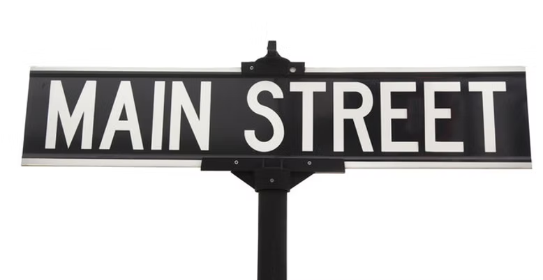
| MAIN_ST_(97038) | Common_name_of_main_road_in_town,_also_Hwy_211 |
| MAPLE_GROVE_RD_(97038) | Area_where_Sawtell_Road_and_Maple_Grove_rd_meet._ _School_built_in_1920’s_returned_to_land_owner_in_late_1980’s,_now_a_private_school. |
| MAPLE_HILL_DR_(97038) | |
| MAPLE_LN_(97038) | Common_name_of_street_for_a_tree. |
| MARIAN_ST_(97038) | |
| MARQUAM_CIR_(97038) | Named_after_Alfred_Marquam,_settler_of_1845._ The_town_just_south_of_Molalla_is_also_named_after_him,_and_first_post_master_there_in_1889. |
| MARY_DR_(97038) | Named_after_Mary_Buckovic._ Husband,_Dick_Buckovic,_was_a_teacher_at_MUHS_for_years._ They_sold_the_property_for_a_subdivision. |
| MATHIAS_CT_(97038) | Named_after_Mathias_Sweigle._ His_settler_father_had_one_of_the_four_corners_in_the_center_of_town_(DLC). |
| MATHIAS_RD_(97038) | Named_after_Mathias_Sweigle._ His_settler_father_had_one_of_the_four_corners_in_the_center_of_town_(DLC). |
| MAY_ST_(97038) | |
| MCCOWN_RD_(97038) | |
| MEADOW_BROOK_LN_(97038) | A_spin_on_“meadow”,_one_of_several_such_named_streets_in_the_subdivision. |
| MEADOW_CT_(97038) | Most_likely_named_because_prior_to_houses_that_was_a_very_large_meadow_owned_by_Harvey/June_Burghardt. |
| MEADOW_DR_(97038) | Most_likely_named_because_prior_to_houses_that_was_a_very_large_meadow_owned_by_Harvey/June_Burghardt. |
| MEADOWLARK_PL_(97038) | A_spin_on_“meadow”,_one_of_several_such_named_streets_in_the_subdivison. |
| MEADOWLAWN_PL_(97038) | A_spin_on_“meadow”,_one_of_several_such_named_streets_in_the_subdivision. |
| MEGAN_RD_(97038) | |
| METZLER_ST_(97038) | Metzler_was_the_name_of_the_owner_of_the_Molalla_Clackamas_Land_and_Developement_Co_ca_1910 |
| MILLER_ST_(97038) | |
| MOLALLA_AVE_(97038) | Named_after_the_Molalla_River_and_American_Natives_of_the_area._City_formed_in_1913,_but_pioneered_in_the_mid_1800’s. |
| MOLALLA_FOREST_RD_(97038) | Formerly_known_as_”the_logging_road”__Crown_Zellerbach_for_log_trucks_to_transport_logs_to_Canby_(Molalla_River).__Thought_it_also_had_designation_as_”world’s_longest”_private_road. |
| MONTE_CRISTO_RD_(97038) | |
| MOUNT_HOPE_RD_(97038) | |
| MOUNTAIN_VIEW_LN_(97038) | |
| MUNSON_RD_(97038) | Munson_family |
| NORTH_FORK_DR_(97038) | A_small_spur_off_of_Lais_Rd_at_the_North_Fork_of_the_Molalla_River |
| NORWAY_CT_(97038) | |
| NOVAK_RD_(97038) | Named_after_the Novak_family._(NEED_HISTORY_ON_THIS_ONE) |
| NOWLENS_BRIDGE_RD_(97038) | There_was_a_#548_Nolan_Mill_Road_recorded_in_1901,_Now_Thomas_Road_and_#521_Nolan_Mill_Road_recorded_in_1900 (Now_Herman_Road).__Not_sure_if_Nowlens_Bridge_Road_has_any_relation_to_Nolan_Mill_Road. |
| OAK_ST_(97038) | |
| ODEAN_RD_(97038) | Fernwood_area.__Named_for_the_Odean_family.__Living_daughter_in_Oregon_city. |
| OLD_MOLALLA_RD_(97038) | Was_part_of_Molalla_Ave,_but_terminated_when_the_old_bar_burnt_down_the_the_road_was_rerouted_into_HWY_213. |
| ONA_WAY_(97038) | |
| ORIENTAL_CT_(97038) | In_Toliver_Estates,_owned/developed_by_Loren_McLoed,_all_streets_are_names_for_Monopoly_properties |
| PACIFIC_CT_(97038) | In_Toliver_Estates,_owned/developed_by_Loren_McLoed,_all_streets_are_names_for_Monopoly_properties |
| PALMER_RD_(97038) | |
| PARK_AV(97038) | The_street_near_Clark’s_Park_in_Molalla. |
| PARK_PL_(97038) | In_Toliver_Estates,_owned/developed_by_Loren_McLoed,_all_streets_are_names_for_Monopoly_properties |
| PATROL_ST_(97038) | |
| PAVELET_RD_(97038) | |
| PEGASUS_CT_(97038) | |
| PENNSYLVANIA_CT_(97038) | In_Toliver_Estates,_owned/developed_by_Loren_McLoed,_all_streets_are_names_for_Monopoly_properties |
| PIERCE_RD_(97038) | |
| PRINCE_CT_(97038) | |
| PROBE_ST_(97038) | Shelmar_subdivision,_developed_by_Wayne_Scott,_named_streets_for_Ford_vehicles. |
| PROSPECT_DR_(97038) | |
| QUINN_RD_(97038) | J.H._Quinn_was_a_donationa_land_claimant_in_the_early_1850s._He_was_from_Kentucky. |
| RACHEL_LARKIN_RD_(97038) | A_dead_end_off_of_Warick_Road,_named_for_early_settler,_Mrs_William_Larkin |
| RACHEL_LN_(97038) | |
| RAMSBY_RD_(97038) | Named_after_the_Ramsby_family;_Early_settlers_settled_at_Dickey_Prairie |
| REDHOUSE_RD_(97038) | Belived_to_be_named_after_the_red_school_house_that_was_once_located_along_that_road. |
| REVILOT_CT_(97038) | It_is_Toliver_spelled_backwards._(OMG…_this_is_so_funny!) |
| RIDGE_DR_(97038) | Common_name_for_roads_along_a_ridge. |
| RIDGE_TOP_DR_(97038) | Common_name_for_roads_on_top_of_a_ridge. |
| RIDINGS_AVE_(97038) | PJ_Ridings,_settler_of_1860s_in_Marquam_area,_son_TO_Ridings_active_in_town_in_early_20th_century,_son_Harold_J_charter_member_of_MAHS |
| RIVERS_ST_(97038) | Off_Toliver_Road,_named_for_the_Bob/Barbara_Rivers_family_when_they_bought_the_property_there. |
| RIVERVIEW_RD_(97038) | Off_of_211,_heads_west_to_Molalla_River |
| ROARING_BULL_LN_(97038) | Named_after_Bull_Creek,_that_the_road_goes_by.__In_the_direction_of_Colton. |
| ROBBINS_ST_(97038) | Named_after_Jacob_and_Sarah_Robbins,_1852_settlers_in_Molalla._They_were_from_Kentucky._ Had_the_big_general_store_in_town_at_4_corners. |
| ROSEWOOD_WAY_(97038) | Rosewood_is_a_type_of_tree–guessing_whomever_built_this_subdivision_up_the_quarry_road_either_thought_they_saw_some_or_felt_it_described_the_area. |
| ROSS_ST_(97038) | |
| ROUNDS_DR_(97038) | |
| SAINT_JAMES_PL_(97038) | In_Toliver_Estates,_owned/developed_by_Loren_McLoed,_all_streets_names_for_Monopoly_properties |
| SAWTELL_RD_(97038) | Sawtell_Brothers_were_settlers_of_the_1850s,_late_1849ws,_John_Newton,_William_Oliver,_Alfred_Joseph.__Sawtell_Road_#107_was_recorded_in_1876.__The_Sawtells_were_from_England_and_grew_teasel_for_packing_with_Chinese_laborers. |
| SCHNEIDER_RD_(97038) | |
| SECTION_ST_(97038) | This_is_where_the_train_stoped_and_dropped_off_people_in_town._ The_train_line_was_called_the_”Molalla_Section”. |
| SHADY_DELL_RD_(97038) | Likely_named_from_the_geographical_site_(a_Dell_down_by_the_Molalla_River),_with_lots_of_shady_trees.__Go_figure. |
| SHANDELL_RD_(97038) | |
| SHAVER_ST_(97038) | Named_after_the_Shaver_family,_early_settlers_of_Molalla_from_late_1800’s_to_early_1900’s._ Large_land_ownership_and_warehouse_in_town_(but_burnt_down)._ John_Shaver_was_Sheriff_of_Molalla_in_1904,_but_was_kill_in_the_line_of_duty_in_1906. |
| SHENANDOAH_DR_(97038) | |
| SHIRLEY_ST_(97038) | Named_for_Shirley_Ridings._The_Ridings_were_early_settlers_of_Molalla. |
| SHORT_FELLOW_RD_(97038) | Named_for_the_Fellows_family_early_homesteaders_up_Haskins_mill_road._ |
| SKYE_LN_(97038) | |
| SODA_SPRING_RD_(97038) | Named_after_the_soda_springs_now_known_as_Wilhoit._ Soda_Springs_Road_was_one_of__the_first_recorded_roads_in_the_South_Molalla_Precinct_in_1869. |
| SPRAGUE_RD_(97038) | |
| SPRING_LAKE_DR_(97038) | |
| STACY_LN_(97038) | |
| STEELHEAD_ST_(97038) | Part_of_Molalla_River_Estates_modern_subdivision_NE_of_town_-_they_all_have_fish_names |
| STONE_HILL_DR_(97038) | One_of_several_“stone”_spinned_streets_at_the_site_of_a_rock_quary,_now_a_populated_housing_area_with_large_lots. |
| STONE_MEADOW_DR_(97038) | One_of_several_“stone”_spinned_streets_at_the_site_of_a_rock_quary,_now_a_populated_housing_area_with_large_lots. |
| STOREY_DR_(97038) | Most_likely_named_for_Dr._Ray/Mildred_Storey._ Dr._Storey_had_the_veterinary_clinic_at_Blackman’s_corner_for_many_years. |
| STOWERS_RD_(97038) | |
| STOWERS_ST_(97038) | |
| STRAUSS_AVE_(97038) | |
| SUMMIT_LN_(97038) | |
| SWIEGLE_AVE_(97038) | Named_for_the_Swiegle_family,_early_settlers_of_Molalla. |
| TALL_TIMBER_LN_(97038) | |
| TAURUS_ST_(97038) | Shelmar_subdivision,_developed_by_Wayne_Scott,_named_streets_for_Ford_vehicles. |
| TAYLOR_CT_(97038) | |
| TEASEL_CREEK_RD_(97038) | Located_near_the_land_of_AJ_Sawtell,_named_for_his_main_crop_and_industry,_teasel |
| THOMAS_RD_(97038) | Thomas_Road_had_an_upper_and_lower_alignment._The_upper_is_used_today._It_was_originally_called_the_Glad_Tidings_to_Soda_Springs_Road_#345,_and_recorded_in_1869.__It_was_later_named_for_RR_and_Elizabeth_Thomas_from_Kentucky_who_arrived_in_the_Molalla_area_to_establish_their_DLC_in_June_1852.__The_road_was_called_the_JHB_Thomas_road_#191,_and_recorded_in_1881._Not_sure_why_the_initials_of_Thomas_are_different_-_maybe_a_son. |
| THUNDERBIRD_ST_(97038) | Shelmar_subdivision,_developed_by_Wayne_Scott,_named_streets_for_Ford_vehicles. |
| TOLIVER_CT_(97038) | Named_after_Dr._Toliver_(dentist)._ Owned_a_lot_of_land_in_that_area,_now_developed. |
| TOLIVER_DR_(97038) | Named_after_Dr._Toliver_(dentist)._ Owned_a_lot_of_land_in_that_area,_now_developed. |
| TOLIVER_RD_(97038) | Named_after_Dr._Toliver_(dentist)._ Owned_a_lot_of_land_in_that_area,_now_developed. |
| TOTEM_VILLAGE_CIR_(97038) | |
| TROUT_CREEK_RD_(97038) | Named_after_the_creek_it_follows.__Likely_due_to_trout_found_in_the_creek.__Feeds_into_the_upper_Molalla_RIver. |
| TROUT_ST_(97038) | Part_of_Molalla_River_Estates_modern_subdivision_NE_of_town_-_they_all_have_fish_names |
| TWIN_RAKES_LN_(97038) | |
| TWIN_ROCK_RD_(97038) | |
| VAUGHAN_RD_(97038) | Named_after_WH_Vaughan,_1842_Settler_(known_as_the_1st_settler_in_the_Molalla!) |
| VENTNOR_CT_(97038) | In_Toliver_Estates,_owned/developed_by_Loren_McLoed,_all_streets_are_named_for_Monopoly_properties |
| VICK_RD_(97038) | Named_after_the_Vick_family_who_ran_the_Liberal_store |
| VILLAGE_DR_(97038) | |
| WARRICK_RD_(97038) | Later_family,_Herbert_Warrick,_nephew_of_Cal_Warrick,_husband_of_Ola_Dibble |
| WATER_ST_(97038) | |
| WEDGEWOOD_DR_(97038) | Dale_Burghardt_developed_Wedgewood_back_in_the_late_1970’s,_but_unsure_of_how_he_came_up_with_the_name |
| WEST_LN_(97038) | |
| WILDCAT_RD_(97038) | |
| WILDERNESS_WAY_(97038) | This_whole_80_acre_parcel_was_a_part_of_my_grandparents_farm_of_600_+_acres._My_grandparents,_Albert_&_Nellie_Mautz,_gave_this_80_acres_to_my_parents_on_their_wedding_day._It_was_sold_in_the_late_1950’s_I_believe_and_was_subdivided_into_the_smaller_acreages_on_it_today._The_story_I_heard_was_it_was_named_Wilderness_Way_by_the_subdivider_because_he_thought_he_was_really_into_the_”Wilderness”_since_he_was_a_city_man_and_it_was_a_”way”_into_the_wilderness. |
| WILHOIT_RD_(97038) | Named_after_John_Wilhoit,_the_settler_who_claimed_and_developed_Wilhoit_Springs_in_1866._John_and_Phoebe_Wilhoit_established_their_DLC_on_the_corner_of_Soda_Springs_and_Thomas_Roads_in_Sept._1852._John_was_from_Kentucky_and_Pheobe_from_Ohio. |
| WINNIFRED_AVE_(97038) | |
| WINSLOW_RD_(97038) | |
| WITTENBURG_AVE_(97038) | |
| WRIGHT_RD_(97038) | Named_for_John_and_Amanda_Wright_from_Kentucky_and_Indiana_respectively. |
| WYLAND_RD_(97038) | Assume_this_is_named_after_the_Wyland_family_(currently_in_Canby). |
| YOUNG_RD_(97038) | |
| ZEPHER_WAY_(97038) | |
| ZIMMERMAN_LN_(97038) |